
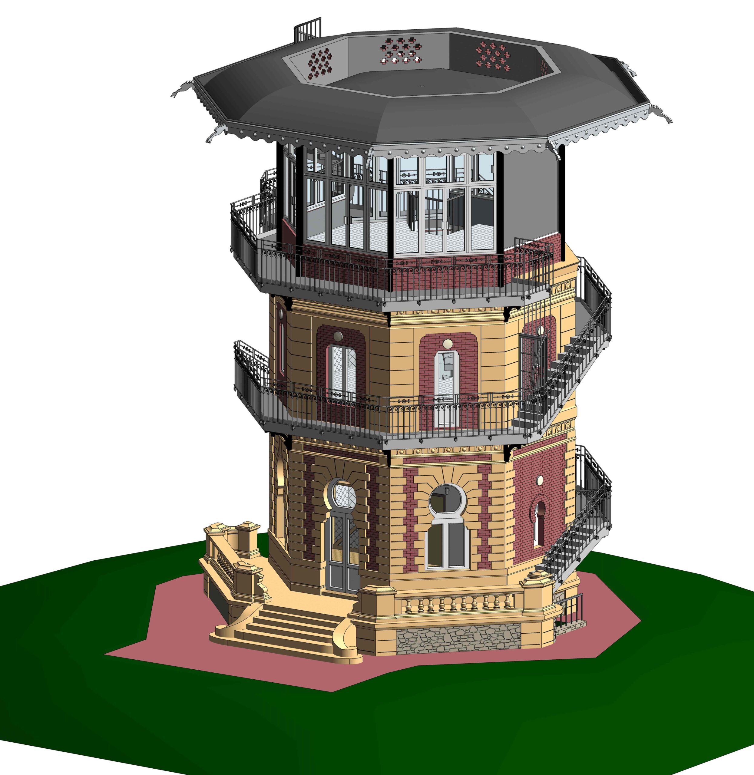


Our firm undertook the renovation project of a historical watchtower house situated in a wildlife sanctuary in France. The client, an architect, provided us with scan files of the entire building. The task involved creating a detailed Building Information Model (BIM) up to Level of Detail (LOD) 400, capturing every intricate detail both externally and internally.


Location: Wildlife Sanctuary, France
Client: Renowned Architect
Scope: Renovation of a Historical Watch Tower House
BIM Services Provided: Detailed Modelling, Quantity Estimation, Schedule Generation
The primary objective was to transform scan file into a comprehensive BIM model at LOD 400, ensuring that every aspect of the building, from its exterior facade to interior details, was accurately presented. Additionally, the model had to serve as a basis for generating material quantities and schedules for construction process to work seamlessly.
The client, being an architect, sought a meticulous and accurate BIM model that would aid in the renovation process. The client provided scan files and expected a detailed working model, including schedules and quantities, within a specified timeline.
The project posed several challenges, notably in modelling the intricate details of the building’s facade. It required a thorough understanding of historical architecture and an intricate balance between precision, efficiency and scalability. Additionally, the timeline provided by our client added pressure to the already detailed and time-consuming process.
The successful completion of this project showcases our firm’s expertise in providing comprehensive BIM services. By overcoming challenges and delivering a detailed and accurate model with quantity estimates and schedules, we have added significant value to the renovation process of this historical watchtower in the heart of a wildlife sanctuary. Our commitment to precision and adherence to timelines reflects our dedication to exceeding our client expectations in every project we undertake.
Uniquescadd brings your vision to life with a skilled team that creates structures accurately as you imagine with the latest technology and the best market rates.


We are just a call/email away. Get in Touch for Accurate and Fast construction projects.
![]() 603, Times Square Grand, Sindhu Bhavan Road, Thaltej, Ahmedabad, Gujarat 380059
603, Times Square Grand, Sindhu Bhavan Road, Thaltej, Ahmedabad, Gujarat 380059